LOOK: Google Earth Hilariously Skewed These Southern Idaho Landmarks
Google Earth is a tool many of us use to pinpoint locations all over the planet. If you've ever used the computer program that utilizes satellite imagery to search for landmarks in the Magic Valley, then you might have had a chuckle or two in the process.
Google Earth is used thousands of times a day by people who want to get all sorts of views of landmarks, highways, streets, neighborhoods, and other points of interest. The software uses satellites in space to give three-dimensional, street views, and aerial looks at just about any expanse the planet has to offer, as well as providing coordinates and other data regarding each location. Heck, it's even helped find sunken cars and ships and aided police in solving crimes.
Southern Idaho Looks Weird In Google Earth Views
I used Google Earth recently to view various landmarks in the Magic Valley. Upon first glance, the Perrine Bridge in Twin Falls appears to show motorists navigating a 75-degree drop to within a few feet of the Snake River before attempting an equally harrowing, vertical ascent up the canyon wall. Other famous area landmarks appear to be completely gone until the software user clicks more directly on the desired location.

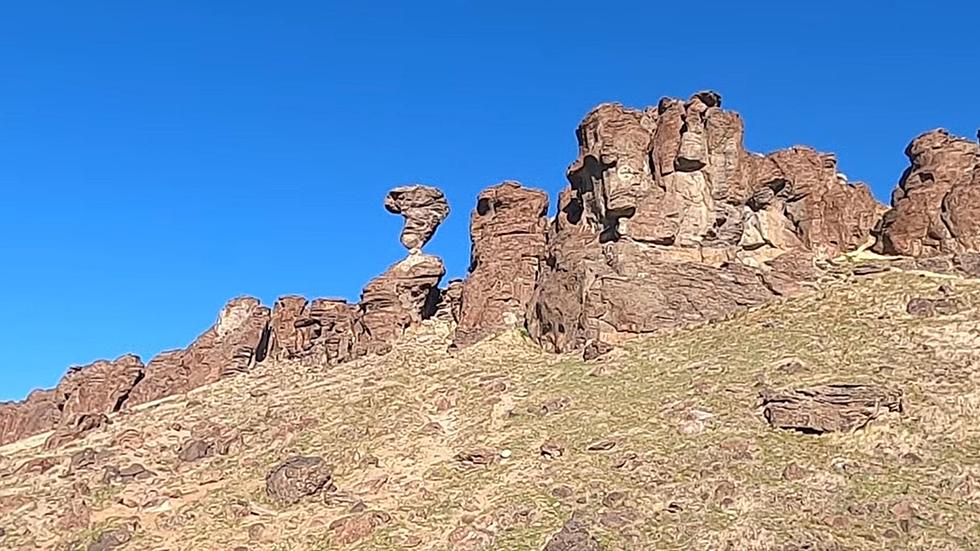
From both the aerial and street views on Google Earth, Balanced Rock appears to have completely disappeared. The Evel Knievel jump site looks like something Wile E. Coyote conceived as part of a plan to capture Road Runner.
Just be sure to spend some time repositioning your angle when using the popular software, or you might just see things from a whole new, distorted point of view.
Idaho Changes From Space
Weird Southern Idaho Sights From Space
More From News Radio 1310 KLIX